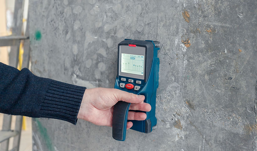
Concrete Scanning Services
Structuretek offers comprehensive Concrete Scanning services, providing clients with accurate and detailed insights into the condition of their concrete structures. Utilising advanced Ground Penetrating Radar technology, we can effectively locate and assess rebar, conduits, voids, and other subsurface features without requiring invasive measures. Our thermal imaging capabilities also allow us to detect anomalies such as moisture ingress or thermal differentials within concrete structures.
Alongside Concrete Scanning, we offer Underground Drain and Utility Surveys to identify and map out underground services, ensuring safe excavation and construction practices. Our Borescope Inspection Surveys enable visual examinations of inaccessible areas within structures, while Drone Surveys provide aerial assessments for roofs, external areas, and large internal spaces. With a comprehensive suite of services, Structuretek delivers reliable and efficient solutions to meet the diverse needs of our clients in asset management and maintenance.
Concrete Scanning
Structuretek have a range of scanning equipment specifically for use in concrete and masonry remediation projects.
Covermeter Surveys - Location, sizing and corrosion assessment of reinforcement with mm accurate concrete cover measurements.
GPR Scanning and Mapping - showing the location and geometry of construction layers, embedded reinforcement, post tensioned cables and voids including determination of concrete slab thickness.
The data collected by our scanning systems can be processed and analysed to create detailed 2D or 3D images of the subsurface.
Benefits:

■ Mobile versatility
■ Immediate insights with 3D and Augmented Reality
■ Portable concrete GPR radar. Faster, easier concrete inspections
■ Hugely beneficial to the design stage assessment and repair strategy.
■ Allows for accurate and faster on-site in-situ mark-ups.
■ Non-destructive method of visualizing the subsurface of an area and identifying features or objects within a surface.
■ Significantly reduces the risk of drilling or interfering with embedded critical reinforcement and services.


Ground Penetrating Radar
We utilise Ground Penetrating Radar to help locate various underground and sub-surface services prior to drilling, cutting, coring or breaking.
■ GPR (Ground Penetrating Radar) is used alongside a suite of other systems such as cable avoidance tools and signal generators (CAT and Genny), concrete scanning and Inspection cameras to avoid underground services and critical reinforcement.
■ Our site operations team are fully trained in locating underground services (LUGS) and Advanced Underground Asset Protection.
■ The data collected by the GPR scans can be processed and analysed to create detailed 2D or 3D images of the subsurface, showing the location and geometry of geological / construction layers, embedded reinforcement, post tensioned cables, voids and foreign objects.
Thermal Imaging
Thermal imaging, also known as thermography or infrared imaging, is a technology used to capture and create images of the heat emitted by objects and surfaces. It allows for the visualization of temperature differences, making it useful for a variety of applications.
Structuretek utilise this technology for;
■ Significantly reducing risk and time by identification of underfloor heating loops and embedded hot water / heating pipework pre-drilling.
■ Identification of water leaks internally and externally both land and air based (Thermographic Drone Camera) not visible to the naked eye.
■ Non-invasive identification of structure types, block wall, cementitious board, externally.
■ Heat Loss detection enabling real time assessment of thermal performance of the building fabric.
■ Location of timber / metal studs, beams/columns internally.

Underground Drain and Utility Surveys
■ Fully delivered in-house service with trained -competent and experience operators - Locating Underground Services (LUGS) trained.
■ Recording the condition of underground drains and the location utility services as part of our site investigations pre-structural repair or refurbishment.
■ Drain camera surveys - Cat and Genny - Ground Penetrating Radar (GPR) systems to accurately locate and document underground services.
■ Documentation of existing damage or defects to underground drainage systems that could potentially be attributed to building settlement. This can include cracks, settling, or other types of structural damage, as well as damage to utilities or other infrastructure.
■ Jet-washing and remediation services available.
Borescope Inspection Surveys
A borescope inspection survey is a non-destructive testing (NDT) technique used to visually inspect the internal condition of equipment or structures without dismantling or disassembling them. It involves using a borescope, which is a flexible optical instrument with a small camera and light source attached to the end of a tube, to inspect inaccessible areas such as cavity walls.
■ Visual inspection and recording of structure cavities, pipework, and inaccessible areas.
■ We have a range of digital borescope instruments capable of reaching awkward cavities with remote viewing and recording capabilities.
■ The data obtained from the borescope inspection can then be used to make informed maintenance and repair decisions.

Concrete Scanning Services FAQ’s
What is the best way to contact our team regarding concrete scanning services?
You can contact our team by phone today for more information on our concrete scanning services!
What is the catchment area of our concrete scanning services?
At Structuretek, we cater our concrete scanning services to clients in Ireland and the UK!


